Welcome to my blog about Romania's Earth Hazards!
Geography
Located in the South East of Europe, Romania is a country that presents a fairly important number of earth disasters, such as earthquakes, flooding and mudslides. Its geography, comprised of mountains, plains, rivers and the Danube River in particular along with the opening at the Black Sea makes up for a terrain that is rife with geological events of interest.
The
Carpathian Mountains divide Romania's upper half from north to south and
connect near the center of the country with the Transylvanian Alps,
running east and west. North and west of these ranges lies the
Transylvanian plateau, and to the south and east are the plains of
Moldavia and Walachia. In its last 190 mi (306 km), the Danube River flows
through Romania only. It enters the Black Sea in northern Dobruja, just
south of the border with Ukraine.
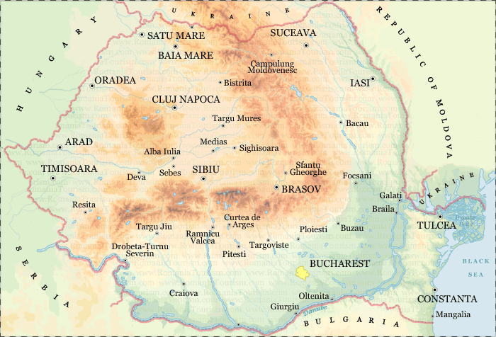
With an area of 238,400 square kilometers, it is the twelfth largest country in Europe and it is halfway between the equator and the North Pole and equidistant from the westernmost part of Europe—the Atlantic Coast --and the most easterly—the Ural Mountains. Romania has 3,195 kilometers of border. Republic of Moldova lies to the east, Bulgaria lies to the south, Serbia to the southwest, and Hungary to the west. In the southeast, 245 kilometers of Black Sea coastline provide an important outlet to the Mediterranean Sea and the Atlantic Ocean.
Let's discover together Romania's geological phenomena and analyze them!


No comments:
Post a Comment